Entry Points:

About Albion Mountains
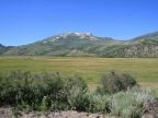
The Albion Mountains run northward from the Utah-Idaho border about thirty miles to the Snake River Basin. Surrounded in all directions by deserts of sagebrush broken by patches of irrigated farmland, they rise to elevations above 9,000 feet with Cache Peak reaching 10,339 feet. With most of the surrounding valleys lying at around 4,500 feet, these peaks rise 5,000 feet above. Being the tallest mountains along the southern edge of the Snake River Basin, they are visible to a great distance on a clear day.
Independence Peak is a shorter twin to Cache Peak, reaching to an elevation of 9,950 feet, just a mile to the northwest. In between them in a cirque lay the Independence Lakes, four small alpine lakes. Mount Harrison stands by itself several miles further north, reaching to 9,265 feet in elevation. Lake Cleveland lies near its peak. Both Cleveland Lake and Independence Lakes are accessible by road and there is a campground at Cleveland Lake. The road to Independence Lakes is a rough backcountry road.
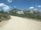
The City of Rocks lies at the southern tip of the Albion Range, a large area of jagged granite outcroppings. It was so named by travelers on the California Trail, which passed through it. The rock formations conjured up images of a ruined city of great stone buildings. It recently became part of the National Park System.
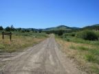
Two smaller mountains are connected to the Albion Mountains on the east, the Jim Sage Mountains, and further north, the Cotterel Mountains. Nestled between these and the Albion Mountains is the beautiful Elba Basin, through which Cassia Creek flows down from Cache Peak and passes eastward between the Jim Sage Mountains and the Cotterel Mountains to reach the Raft River Valley. The Raft River Valley is an extension of the Snake River Basin which comes down the east side of Cotterel Mountains, and extends around the south end of the Jim Sage Mountains, and reaches to the very southern tip of the Albion Mountains.
On the northern end of the Albion Mountains a basin is formed between the Cotterel Mountains, the Albion Mountains, and the East Hills, the northernmost extension of the Albion Mountains. In this basin is found the pioneer town of Albion, for which the mountains are named.
Street Index
|
a dirt road a road a trail Emery Canyon Road |
Hereford Pasture Road Howell Canyon Road Independence Lakes Road Mount Harrison Overlook |
New Canyon Road Oakley - Elba Road Ottley Road |