Entry Points:

About Pocatello
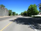
Pocatello lies in the mouth of the valley of the Portneuf River where it flows out of the mountains of southeastern Idaho. To the north is the flat terrain of the Snake River Basin and on either sides are the foothills of the mountains, covered with grass and sagebrush, with trees growing on the higher slopes. The Portneuf River flows along the hills on the western side of town.
In the mid 1800s, thousands of travelers on the Oregon Trail passes through Pocatello. When the Utah and Northern Railroad was built, running from Utah up into Montana, a rest stop was built at Pocatello. In 1882 the Oregon Shortline Railroad connected to Pocatello and it became known as Pocatello Junction. It was also called the “Gateway to the Northwest,” as all travelers headed that way came through Pocatello.
Pocatello had been the territory of the Shoshone Indians led by Chief Pocatello. After years of resisting having their lands taken over by outsiders, they signed the Box Elder Treaty, which created the Fort Hall Indian Reservation, which still covers the ground to the north and west of Pocatello. In 1888, 1,840 acres were taken from the Fort Hall Reservation to create the City of Pocatello, which was officially incorporated in 1889.
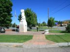
Early Pocatello is reported to have been a rough and wild place with lots of smoke. It has grown to one of the largest towns in Idaho, and was in fact the largest for a while in 1962. Today it is a center of government, business and education, with the campus of Idaho State University (ISU) occupying the southwest corner of town.
Interstates 15 and 86 serve the Pocatello area. I-15 passes southward into Marsh Valley and northward toward Idaho Falls and other cities in the Snake River Basin. I-86 begins at an interchange with I-15 north of Pocatello and heads westward towards American Falls. U.S. Highway 91 passes through Pocatello, paralleling I-15 and U.S. Highway 30 briefly leaves the freeway to pass through Pocatello before rejoining I-86 heading westward.
The mountains surrounding Pocatello provide an opportunity for getting out of town for recreation, particularly Scout Mountain, directly to the south, and Mink Creek Canyon.
For More Information:
See the City of Pocatello website at www.pocatello.us and Wikipedia’s Pocatello article.