Entry Points:
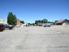

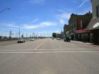
About Lincoln County
Lincoln County was created by the Idaho Legislature on March 18, 1895, being divided off of Blaine County. It is named after President Abraham Lincoln who was president thirty years earlier. Lincoln County was later divided on two occasions. On January 28, 1913, Gooding County was created on the west, and Minidoka County on the east. On February 8, 1919, Jerome County was separated off to the south. Shoshone is the county seat and largest city.
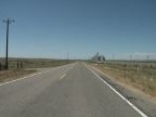
Lincoln County occupies a spot along the northern edge of the Snake River Basin, a large area of southern Idaho formed by lava flows which spread out into a large flat valley in the midst of the Rocky Mountains. The Snake River flows from east to west through the basin, and the basin provided a natural avenue for settlement through the area. Many areas of Lincoln County are covered by jagged outcroppings of lava, but many areas are under irrigation to provide fertile farmland. The terrain of the county is marked by gentles slopes and large hills of little height (called buttes). The northeast corner is especially shaped by the rugged lava flows. On the northern boundary, the ground slopes up to the Mount Bennett Hills, which reach as high as 6,000 feet in elevation.
There are no freeways in Lincoln County, and all of the highways meet at Shoshone, which is located near the southwest corner of the county. U.S. Highway 93 goes south from Shoshone, and U.S. Highway 26 goes west. These two routes combine at Shoshone and leave heading northeast. State Highway 75 strikes out to the north, and State Highway 24 heads east.
Lincoln County has a population of 4,044 and covers 1,206 square miles.
Other Lincoln Counties:
Many states include a Lincoln County. On UntraveledRoad, you can also visit Lincoln County in Wyoming.