Entry Points:

About Heyburn
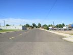
Heyburn is residential town across the Snake River from Burley in the Magic Valley area of Idaho. Because of its proximity to shopping venues in Burley, Heyburn has no commercial areas of its own. A grid of streets a few blocks wide and quite long (ending with Z Street), constitutes the core of the town. 21st is the main east-west route and U.S. Highway 30 passes through the east end of town, crossing the Snake River on the south, and connecting with Interstate 84 a short distance to the north.
In the first decade of the 1900s, the United States Bureau of Reclamation built irrigation projects using water from the Snake River to turn the deserts into farmland. Many communities sprang up during this time, one of which was Heyburn. It was named after Weldon Heyburn, a U.S. Senator from Idaho at the time.
The Snake River makes a bend around the south side of the town, making its closest approach at the west end of town. Farmland surrounds Heyburn in most directions. The Albion Mountains can be seen to the southeast.
For More Information:
See the Wikipedia article on Heyburn.