Entry Points:

About Hagerman
Hagerman lies in Hagerman Valley, a widening of the Snake River Gorge. Surrounded by the Snake River Plain, the Snake River crosses southern Idaho, mostly in a gorge hundreds of feet deep. At Hagerman, the gorge widens to a valley as much as a few miles wide. Immediately to the north it narrows down again. The steep slopes of the gorge line the valley on each side, capped by outcroppings of lava rock. The valley is filled with farmland, thanks to irrigation water from the river. Billingsley Creek comes from springs behind Hagerman and descends in a canyon of its own. Several miles to the north, the Malad River Gorge joins the Snake River, another scenic tributary.
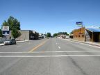
U.S. Highway 30 passes through Hagerman as its main north-south street, called State Street. It continues north to Bliss. To the south it goes to Buhl after crossing the Snake River.
The population of Hagerman at the 2010 census was 872. The elevation ranges from about 2,900 feet to 3,100 feet.
For More Information:
See the Hagerman Chamber of Commerce site, and Wikipedia's Hagerman article.