Entry Points:

About Declo
The rural town of Declo lies a short distance from the Snake River in the rich farmlands of the Snake River Basin. To the southeast the East Hills rise from the otherwise flat landscape, rising to the heights of the Albion Mountains further south. Mount Harrison is the peak visible from Declo, at an elevation of 9,265 feet.
Declo is in an area called Magic Valley, which is so named because of its transformation from desert to farmland using water from the Snake River. These irrigation projects were built in the early 1900s and Declo was settled about this time. It was originally named Marshfield, and received its current name about 1916. The population of Declo was 338 at the 2000 census. Its elevation is 4,219 feet.
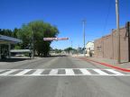
Declo is on the one-time route of U.S. Highway 30 South, an alternate route of highway 30, which ran southeast across the Raft River Valley and across northern Utah. This route was decommissioned when the freeways were built and the portion passing Declo is designated as Idaho Highway 81. It travels east-west on the north side of the train tracks, bypassing the main part of town. To the west, it leads to Burley, the nearest large town. Idaho Highway 77 also passes through Declo passing north and south. It connects to Interstate 84 a few miles to the north, and heads south to Albion, and older settlement at the feet of the Albion Mountains.
Declo has a claim to history in the story of J.R. Simplot, who, as a 14 year-old boy living in Declo, founded the world's largest potato processing company in 1923. Today it operates out of Boise and still bears his name.
For More Information:
Read about Declo in Wikipedia.
Street Index
|
Center Street Clark Street First East Street First West Street |
Fourth West Street Main Street Second East Street Second South Street |
Second West Street State Highway 81 Third West Street |