Entry Points:

About Cassia County
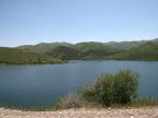
Cassia County covers 2,580 square miles between the Snake River and Idaho's southern boundary. It includes a significant portion of the Snake River Basin along the northern half, with mountain ranges jutting into the southern portion. The area along the Snake River, including Burley, is part of the Magic Valley region, so named because of its conversion from desert to farmland using irrigation water from the river.
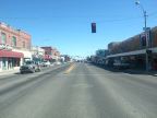
Burley is the county seat, and largest city, and lies right on the county's northern boundary. Albion, an earlier settlement, was the county seat from 1879 to 1918. Albion was settled by Mormon pioneers, along with Oakley, another small town south of Burley.
U.S. Highway 30 crosses the northern portion of the county from east to west, and Interstate 84 traverses the Raft River Valley diagonally, crossing out of the county not far to the northeast of Burley. Idaho Highway 27 connects from Oakley to Burley and northward into Minidoka County. Idaho Highway 77 connects Albion to the freeway, and extends further south. Idaho Highway 81 follows the Raft River.
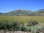
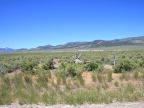
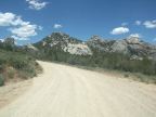
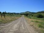
With such a large land area (two and a half times the size of Rhode Island), Cassia County has a variety of mountains and valleys. The Snake River Basin covers the northern portions of the county. Mountains lie along the southern border. The Sublette Range is divided in half by the county's eastern boundary, with the other side being in adjoining Power County. With peaks above 7,000 feet, the Sublette Range rises not far south of the Snake River and extending southward and slightly eastward, with its southern tip in Power County. A narrow valley called Juniper Valley separates the Sublettes from Black Pine Peak, which occupies the southeast corner of the county. West of these mountains is the Raft River Valley, a wide and arid area covered with sagebrush and grassland. Few people live in this area, and much of it is not farmed. The Jim Sage Mountains and Cotterel Mountains form the Raft River Valley's western side, and immediately beyond them are the Albion Mountains, with the 10,339-foot Cache Peak. At the south end of this mountain range, a unique and striking region of rocky outcroppings has been designated as the City of Rocks National Reserve. To the east of the Albion Mountains the Snake River Basin extends as far southward as Oakley. A rugged terrain of hills and minor mountains cover the county's southwest corner.
The irrigation of the Magic Valley region was undertaken in the first decade of the 1900s, and led to the major settlements of the county. "Magic" refers to the transformation of the desert to fertile farmland.