Entry Points:

About Albion
Albion lies in a basin in the Albion Mountains surrounded by farmland and beautiful mountain peaks. Mount Harrison reaches 9,200 feet in elevation just a few miles south of Albion. The Cotterel Mountains lie to the east and the East Hills to the north. The elevation is 4,700 feet, about 500 feet higher than the valley a few miles to the northeast.
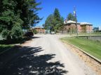
Albion is one of the early settlements of Idaho, being settled in the late 1800s. In 1885, Cassia County purchased an unfinished hotel for its courthouse in Albion. In 1894, the Albion State Normal School opened in Albion, which taught many school teachers for Idaho. The empty buildings of the campus still sit at the northeast corner of town on a hill.
In its early days, Albion experienced much conflict between sheepherders and cattlemen, and Mormons and non-Mormons. The famous trial of Diamondfield Jack over the murder of two sheepherders here polarized this conflict and drew the attention of intermountain west.
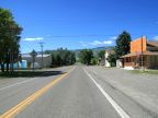
Idaho Highway 77 passes through Albion headed southeast to northwest. It comes up Main Street, then makes a 90 degree turn onto North Street. After leaving town to the northwest, it drops into the Snake River Basin, passes through Declo and ends at Interstate 84. To the southeast it leads to Malta in the Raft River Valley.
For More Information:
See the Wikipedia Albion article.