Entry Points:

About Custer County
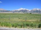
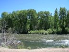
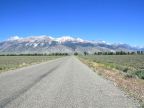
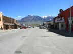
Custer County lies in the mountains of central Idaho and is home to Borah Peak, the highest point in Idaho at 12,662 feet in elevation. The Lost River mountain range, which Borah Peak is a part of, lies at the center of the county, a towering wall of snow-capped, stony mountain peaks, with the Lost River Valley to the southeast and the Pahsimeroi Valley to the northwest. The tops of the Pioneer Mountain range forms its western boundary, and the county seat, Challis, lies in Round Valley, at the northern tip of the county. The Big Lost River flows out of the Pioneer Mountains and then southeast through the valley named after it, and then out into the lava fields of the Snake River Basin, where it disappears into the ground.
Custer County was organized in 1881, and named after the General Custer Mine, where gold was discovered five years before. It is a rural and mountainous country, with a population of just 4,342 (in 2000), spread over its 4,937 square miles. It occupies a central location in the state of Idaho.
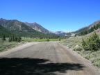
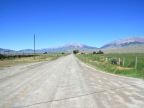
U.S. Highway 93 is the main route of travel through Custer County, passing up through the Lost River Valley, and then crossing into Round Valley. It serves the city of Challis. State Highway 28 passes along the other side of the Lost River Range, and Idaho Highway 75 crosses the mountains at the northwest end of the county, ending at Challis.
For More Information:
See Wikipedia's Custer County article.