Entry Points:

About Challis
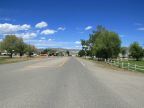
Challis is a mining town perched on the hills west of Round Valley. The Salmon River flows past on the far side of the valley, a moderately large river, and Garden Creek flows out of the mountains west of Challis, and through the town to meet it. A large barren slope of rock and orange earth stands just north of the creek, making a landmark visible across the south end of the valley. The valley floor is green with grassland, and the hills are drier with patches of sagebrush. The mountaintops are forested.
Mining in the area led to the settlement of Challis in 1876 as a supply depot for miners. It was platted by Alvah Challis. As mining dwindled in the area, ranching took its place in the local economy. Numerous old mining towns in the area are popular tourist destinations, as are the vast wilderness areas surrounding Challis.
Challis is the county seat of Custer County, and it sits in a sparsely populated, mountainous area of central Idaho. U.S. Highway 93 passes by the east end of town, connecting to the distant towns of Mackay to the south and Salmon to the north. Idaho Highway 75 begins just south of Challis, and loops through the Sawtooth Mountains coming to Ketchum. The population of Challis was 909 at the 2000 census. Challis is built on a slope between the mountains and the Salmon River, with elevations ranging from 5,000 feet near the river to about 5,300 feet.
For More Information:
See Challis’ official site at www.challisidaho.com
and the Wikipedia article Challis, Idaho.
Street Index
|
Atlas Lane Blue Mountain Road Eleventh Street Leesburg Lane |
Main Street Pleasant Avenue U.S. Highway 93 Valley Avenue |