Entry Points:

About Elmore County
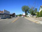
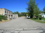
Elmore County lies the southwestern corner of Idaho, covering 3,078 square miles. It was created on February 7, 1889 with the county seat at Rocky Bar and it was named after the Ida Elmore Mines, a major mining operation of the early days of the county. When the mining boom was over Rocky Bar became a ghost town and the county seat was moved to Mountain Home. The population as of the year 2000 was 29,130. The two main cities in the county, Mountain Home and Glenn's Ferry, both originated as stops on early travel routes through the area.
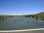
The Snake River is the southern boundary of the county. A narrow river valley lines the river ending in a steep climb to the Snake River Plain. A cap of lava covers the top of the slope and can be seen poking through the sagebrush and desert grasses for miles to the north. After a series of hills, the elevation climbs and the northern boundary lies in the Boise Mountains.
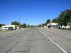
Interstate 84 is the main artery of travel through the area, passing through the Snake River Plain and past both Glenn's Ferry and Mountain Home. U.S. Highway 20 enters the county from the east and joins the freeway at Mountain Home. State Highways 67 and 51 both begin at Mountain Home and head toward the Snake River. Highway 67 heads southwest and ends at Grand View; highway 51 goes nearly southward, passes through Bruneau and on into Nevada.